
Map of Amboseli national park
Map of Amboseli National Park.
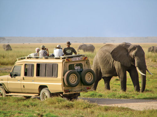
:Amboseli national park Is among the most visited tourist destinations located in Kenya in Kajiado district 95km from Nairobi city. The detailed map of Kenya’s most popular Amboseli national park shows the main roads connecting to the park, the neighboring national parks, cottages, safari camps, the main park gates to the park, water bodies and streams, the major hills etc. Different gates connect to the park, the Meshanani gate, Kiritua gate, Iremito gate, Kimana gate which is the main gate to the park and sometimes the only gate functioning. According to Kenya safari guide, travel along the Nairobi-Arusha road via Namanga and enter the park through the Meshanani gate. An alternate route is to travel the Mombasa route and this means you will enter the park through the Tsavo national park by the Kimana gate. The park is located near the KWS Headquarters, KWS lodges and camping site.


Many thanks for the top notch information and facts covered throughout your website, what follows is a trivial quiz for your blog site readers. Exactly who said the following quote? . . . .Speak softly and carry a big stick; you will go far.